- Photos & Map
How would you like to arrive?
- Description
- Good to know
- 17:00 h
- 43.40 km
- 2,181 m
- 3,219 m
- 1,007 m
- 2,871 m
- 1,864 m
- Start: Belalp, cable car mountain station
- Destination: Fiesch, public transport hub
Day 1
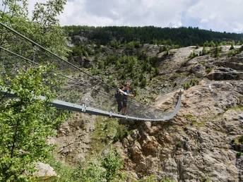
The starting point of the route is the Hotel Belalp. You hike down via the Steigle into the Aletschji and further over Leng Acker to the old glacier ascent and the Belalp – Riederalp suspension bridge. The 124 m long and 80 m high suspension bridge is the highlight of this stage! After crossing it, you start the ascent to Riederfurka. From Riederfurka, you hike down to your first stage destination Riederalp.
Overnight stay: Accommodations Riederalp
Day 2
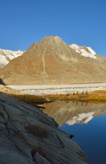
From Riederalp, you take the glacier railway up to the Moosfluh viewpoint, which is the starting point of the second stage of the day. Follow the eastward leading path to Biel and then take the short ascent to Hohbalm. From there, you hike along the north-facing slopes of Bettmerhorn and Eggishorn, without major elevation changes, to Märjelensee. The view of the Great Aletsch Glacier is your constant companion on this stage.
Overnight stay: Glacier Hut
Day 3
From the mountain hut Glacier Hut, you ascend to the small Tällisee, which is a beautiful viewpoint, and then onwards to Tälligrat. This section runs over a nicely laid slab path. Then it goes over switchbacks up to Horli-Hitta and to the Eggishorn viewpoint, where you can expect a unique view. Afterwards, you hike back the same way to the Glacier Hut. The last part of the day’s stage leads down over Märjelenwang to the Castle Hut.
Overnight stay: Castle Hut
Day 4
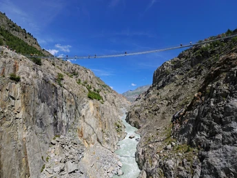
Day 4 holds pure thrills: The route begins with a relatively demanding, steep descent which requires surefootedness. You must master about 600 meters of altitude in this terrain. Then follows crossing the 160 m long Aspi-Titter suspension bridge, which spans 120 m above the Weisswasser gorge. This requires no fear of heights but guarantees impressive views into the depths. After crossing, the route continues challenging: surefootedness and no fear of heights are also required on the steep ascent to the highest point of the hike. Once there, you hike to Bellwald and then descending further via Fürgangen to the second suspension bridge of this day stage: the 280 m long Goms Bridge which leads over the wild Rotten, which makes its way 92 meters below. You cross the bridge and arrive at Mühlebach. Here you will find restaurants where you can recharge reserves for the last stage. This leads you via Ernen to Fiesch.
Good to know
Directions
Day 1: Belalp - Hotel Belalp - Aletschji - Suspension Bridge - Riederfurka - Riederalp
Duration 5 h | Distance 11.4 km | Ascent 604 m | Descent 782 m
Day 2: Moosfluh – Biel – Hohbalm – Roti Chumme – Märjelensee – Glacier Hut
Duration 4 h | Distance 10.6 km | Ascent 735 m | Descent 282 m
Day 3: Eggishorn – Tälligrat/Tällisee – Glacier Hut - Castle Hut
Duration 4 h | Distance 10.2 km | Ascent 508 m | Descent 1123 m
Day 4: Aspi-Titter Suspension Bridge - Bellwald - Fürgangen - Goms Bridge - Mühlebach - Ernen Fiesch
Duration 4 h | Distance 11.9 km | Ascent 262 m | Descent 964 m
Safety guidelines
The use of the hiking trails and information on this website is at your own risk. The on-site conditions may cause changes to the route. Aletsch Arena AG assumes no responsibility for the accuracy and completeness of the information on this website.
- Crossing the Belalp - Riederalp suspension bridge requires surefootedness and no fear of heights. Also pay close attention to local warning and information signs.
- Carry a map with you. Download the complete description of the hiking trail with a large-scale map by clicking "Print" at the top right of the page.
- Use only marked hiking trails and observe all signposts and instructions—for your own safety, to protect grazing animals, and out of respect for wildlife.
- Close gates after passing through them.
- Be considerate towards other trail users, plants, and animals.
Tour information
Stop at an Inn
Best to visit
Pavements
Equipment
We recommend:
- Good footwear
- Weather-dependent clothing: always carry a waterproof vest
- Headwear
- Sunscreen
- Water bottle
- Picnic
- Camera
- Binoculars (optional)
- Hiking poles (optional)
- Printout of the hiking trail (click "Print" to download)
Directions & Parking facilities
Additional information
Aletsch Arena AG
Furkastrasse 39
CH-3983 Mörel-Filet
+41 27 928 58 58
Literature
Author´s Tip / Recommendation of the author
Get the Aletsch Explorer Pass! With the combined mountain railway and train ticket, you are unrestrictedly mobile in the Aletsch Arena!
Map


