- Photos & Map
How would you like to arrive?
- Description
- Good to know
Download GPX file
- 0:30 h
- 706 m
- 30 m
- 30 m
- 2,304 m
- 2,333 m
- 29 m
- Start: Moosfluh Glacier Railway mountain station
- Destination: Moosfluh Glacier Railway mountain station
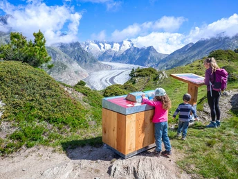
The Moosfluh glacier railway from the Riederalp takes you to the ridge, from where you hike westwards to the start of the themed trail. The circular route deals with the effects of global warming and glacier melting at the Aletsch Glacier. Children can approach the topics playfully with the glacier flea "Gletschi".
The first station "Welcome" shows you the map of the themed trail and gives an introduction to the topic.
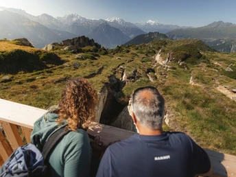
The second station "Aletsch Marks" impressively shows the traces of the glacier and how far it once carved its way. You can look through a specially positioned viewing panel.
The third station "Climate Change" shows how the mountain loses its support and the rock breaks. Children can experience this playfully with a tipping game.
The fourth station "Melting Glacier" indicates the changes of the Great Aletsch Glacier through a turning game.
The fifth station "Moving Rock" shows the effects on the Moosfluh and explains the formation of rock cracks. Children can free Gletschi from a sliding maze of rock cracks.
The sixth station "Moosfluh Combi Lift" explains the effects of the moving mountain on the construction of a mountain railway. Children can prove themselves in a memory game.
The seventh station "Mountain Monitoring" illustrates mountain monitoring. Changes in the rock cracks are shown by a measuring tape that moves along. Children's eyes are tested by a seek-and-find picture.
The themed trail is not pram-friendly and not barrier-free.
Good to know
Safety guidelines
The use of the hiking trails and information on this website is at your own risk. On-site conditions may cause route changes. Aletsch Arena AG accepts no responsibility for the accuracy and completeness of the information on this website.
For all hikes:
- Carry a map with you. Download the full description of the hiking trail with a large-scale map by clicking "Print" at the top right of the page.
- Use only marked hiking trails and observe all signposts and instructions - for your own safety, the protection of grazing animals, and respect for wildlife.
- Close gates after passage.
- Behave considerately towards other trail users, plants, and animals
Tour information
Cultural Interesting
Familiy-Friendly
Loop Road
Best to visit
Pavements
Equipment
We recommend:
- Good footwear
- Weather-dependent clothing: always carry a waterproof vest
- Headgear
- Sunscreen
- Water bottle
- Picnic
- Camera
- Binoculars (optional)
- Walking poles (optional)
- Printout of the hiking trail (click "Print" to download)
Directions & Parking facilities
Take Cantonal Road 19 to the Mörel-Filet exit, then continue to the signposted parking facilities. Take the Riederalp aerial cableway (Aletsch Bahnen AG) up to the Riederalp.
- Limited number of paid parking spaces at Mörel-Filet train station. Further parking options are signposted.
- Large paid parking garages at the entrance to Mörel-Filet as well as in the village center.
By train from Brig or Oberwald to Mörel-Filet, then continue on foot to the Riederalp aerial cableway (Aletsch Bahnen AG). Take this up to the Riederalp.
Additional information
Aletsch Arena AG
Furkastrasse 39
CH-3983 Mörel-Filet
+41 27 928 58 58
info@aletscharena.ch
www.aletscharena.ch
Literature
You can get a free panoramic map at the mountain railways and infocenters of the Aletsch Arena.
Author´s Tip / Recommendation of the author
Visit the View Point Moosfluh and enjoy the unobstructed view of the Great Aletsch Glacier.
Map
SwissTopo national maps: 1:25,000: 1269 Aletsch Glacier


