- Photos & Map
How would you like to arrive?
- Description
- Good to know
- 3:15 h
- 6.69 km
- 866 m
- 138 m
- 1,924 m
- 2,787 m
- 863 m
- Start: Bettmeralp, top station of aerial cable car
- Destination: Bettmerhorn, top station of the Bettmerhorn gondola
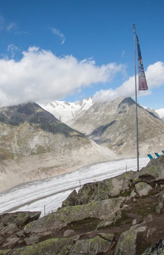
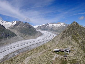
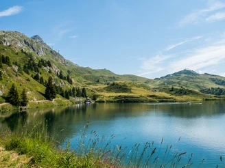
From the mountain station of the Bettmeralp cable car, first head east via Bettmeralp and then up to Lake Bettmersee. The beautifully laid out hiking trail begins on the east side of the idyllic mountain lake. The trail leads via Schönbiel and Hohbalm, reaching Bettmerhorn mountain station in around two hours. From there, you’ll tackle the roughly 30-minute climb to the summit of the Bettmerhorn. The climb up the southern flank of the mountain branches off directly in front of the mountain restaurant, and requires some physical fitness but above all sure-footedness! However, it is well secured with cables as well as wooden steps in some areas. Once you arrive at the summit of the Bettmerhorn, you should take the time to fully enjoy the breathtaking panoramic view of the Great Aletsch Glacier and the four-thousand-metre Valais peaks before heading back down to the mountain station on the same path as before. From there, take the gondola down to Bettmeralp.
Good to know
Directions
Safety guidelines
Use of the trails and the information on this website is at hikers’ own risk. Local conditions may entail changes to routes. Aletsch Arena AG accepts no liability for the accuracy and completeness of information on this website.
- Bring a map. Download full description of this route including large-scale map by clicking on «Print» icon, top right of this page.
- Use marked trails only, and observe all signposting – for your own safety, to safeguard grazing animals and to avoid disturbing wildlife.
- Close gates after passing through.
- Please be considerate to other trail users, and to the plants and animals.
- Do not leave any waste in nature.
Tour information
Stop at an Inn
Summit
Best to visit
Pavements
Equipment
We recommend:
- good footwear
- clothing suitable for the weather: always carry a waterproof jacket
- hat or cap
- sunscreen
- bottle for water
- picnic
- camera
- swimwear
- binoculars (optional)
- hiking poles (optional)
- printout of this hike (click «Print» icon, to download)
Directions & Parking facilities
Additional information
Literature
Author´s Tip / Recommendation of the author
Map


