- Photos & Map
How would you like to arrive?
- Description
- Good to know
Download GPX file
- 3:30 h
- 8.17 km
- 647 m
- 647 m
- 741 m
- 1,382 m
- 641 m
- Start: Mörel, train station
- Destination: Mörel, train station
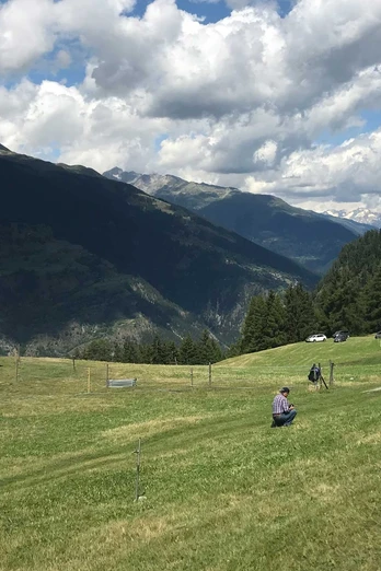
From Mörel-Filet train station, walk the short stretch up to the main road and then continue westward to the Aletsch parking. From there, follow the narrow path down to the Mörel power station and cross the Rotten river. Through the shady Lägund forest, hike up to Zen Achru. Via Erlis, the path leads along the Tunetsch cliff over meadows further uphill until after a short forest section you reach the alpine pastures of Tunetschalp. Here, three cultural and themed routes invite you to interesting and educational circular walks: the chapel route, the Nieschrund route, and the lime kiln route. Follow a steep, old sledding path that was previously used as a fast transport route downhill back to the valley, to the district of Filet. From there, you reach the Mörel-Filet train station again within just a few minutes on foot.
Good to know
Directions
Safety guidelines
Use of the hiking trails and information on this website is at your own risk. Conditions on site may cause changes to the route. Aletsch Arena AG accepts no responsibility for the accuracy and completeness of information on this website.
- Crossing the Tunetsch gorge requires surefootedness. Pay careful attention to local warning and information signs.
Carry a map with you. Download the complete description of the hiking trail with a large-scale map by clicking «Print» at the top right of the page.
Use only marked hiking trails and follow all signposts and instructions—for your own safety, to protect grazing animals, and out of respect for wildlife.
Close gates after passing through.
Behave considerately towards other trail users, plants, and animals.
Tour information
Loop Road
Best to visit
Pavements
Equipment
We recommend:
- Good footwear
- Weather-dependent clothing: always carry a waterproof vest
- Headwear
- Sun protection
- Water bottle
- Picnic
- Camera
- Binoculars (optional)
- Walking sticks (optional)
- Printout of the hiking route (click «Print» to download)
Directions & Parking facilities
- Limited number of paid parking spaces at Mörel-Filet train station. Additional parking options are signposted.
- Large paid parking garages at the entrance to Mörel-Filet as well as in the village center.
Additional information
Aletsch Arena AG
Furkastrasse 39
CH-3983 Mörel-Filet
+41 27 928 58 58
info@aletscharena.ch
www.aletscharena.ch
Literature
Author´s Tip / Recommendation of the author
Map


