- Photos & Map
How would you like to arrive?
- Description
- Good to know
Download GPX file
- 4:00 h
- 9.59 km
- 606 m
- 615 m
- 1,492 m
- 2,066 m
- 574 m
- Start: Riederalp, cable car station (West)
- Destination: Riederalp, cable car station (West)
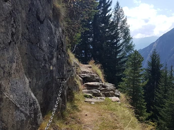
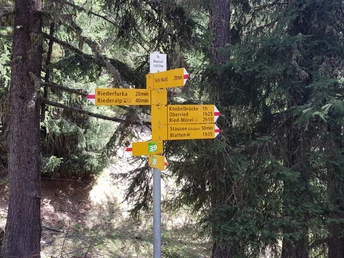
Starting from Riederalp, this hiking trail circles around the Riederhorn. The path first leads up to the Riederfurka, then in a large loop below the Casselweg around the Riederhorn down to Oberried and then back up to Riederalp. Along the way, three toggle bridges are crossed, some path sections are somewhat exposed. From mid-June to mid-October, this hiking trail offers a lot of variety in the middle of the UNESCO World Natural Heritage site: hikers cross a total of three bridges that are built from round wooden toggles. Hence the name «Toggle Bridges Trail». Previously, the constructions were somewhat more rustic and dangerous. Today the bridges are easy to cross, though somewhat exposed. Along the way, you look towards the valley communities and the Gibidum reservoir above the Massaschlucht. The gorge was carved into the rock long ago by the ice of the Great Aletsch Glacier. A special highlight of the hike is the historic Villa Cassel, built in 1902, on the Riederfurka. Surrounded by green meadows and snow-covered four-thousanders in the background, the magnificent building doesn't quite fit into the original landscape. It was the private holiday residence of Sir Ernest Cassel, a very wealthy German-British banker. Before the descent towards the toggle bridges, a refreshment is recommended in the tea salon of the Victorian villa, where illustrious guests such as Winston Churchill once came and went. Today the historic house is home to the Pro Natura Center Aletsch, a nature conservation center with a guesthouse – and at the same time the gateway to the UNESCO World Heritage Jungfrau-Aletsch.
Good to know
Directions
Safety guidelines
Use of the hiking trails and information on this website is at your own risk. Conditions on site may cause changes to the route. Aletsch Arena AG accepts no responsibility for the accuracy and completeness of the information on this website.
- Carry a map with you. Download the complete description of the hiking trail with a large-scale map by clicking «Print» at the top right of the page.
- Use only marked hiking trails and observe all signs and instructions - for your own safety, to protect grazing animals and out of respect for wildlife.
- Close gates after passing through.
- Be considerate of other trail users, plants, and animals.
Tour information
Familiy-Friendly
Loop Road
Stop at an Inn
Best to visit
Pavements
Equipment
We recommend:
- Good footwear
- Weather-dependent clothing: always carry a waterproof jacket
- Head covering
- Sunscreen
- Water bottle
- Picnic
- Camera
- Binoculars (optional)
- Walking sticks (optional)
- Printout of the hiking trail (click «Print» to download)
Directions & Parking facilities
- Limited number of paid parking spaces at Mörel-Filet station. Additional parking options are signposted.
- Large paid parking garages at the entrance to Mörel-Filet and in the village center.
Additional information
Furkastrasse 39
CH-3983 Mörel-Filet
+41 27 928 58 58
info@aletscharena.ch
www.aletscharena.ch
Literature
Author´s Tip / Recommendation of the author
Map


