- Photos & Map
How would you like to arrive?
- Description
- Good to know
- 31:00 h
- 85.98 km
- 4,830 m
- 3,582 m
- 698 m
- 2,489 m
- 1,791 m
- Start: Bitsch
- Destination: Ladstafel
6 days hike |31 h | 87 km | 4830 Hm | 3582 Hm
Day 1: Bitsch – suspension bridge Massegga – Geimen – Blatten – Belalp (Aletschbord) - 5 h | 11.5 km | 1492 Hm | 59 Hm
Day 2: Belalp (Aletschbord) – suspension bridge Belalp – Riederalp – Riederfurka – Riederalp - 3.45 h | 9.5 km | 560 Hm | 792 Hm
Day 3: Riederalp – Riederfurka – Hohfluh – Moosfluh – Panoramaweg – Märjelensee – (Tunnel) – Fiescheralp -6 h | 17.5 km | 813 Hm | 504 Hm
Day 4: Fiescheralp – Unneres Tälli – Gletscherstube – Märjelenwang – Burghütte – suspension bridge Aspi-Titter – Ried – Bellwald - 5.30 h | 14 km | 505 Hm | 1081 Hm
Day 5: Bellwald – Fürgangen – suspension bridge Fürgangen-Mühlebach "Goms Bridge" – Mühlebach – Niederwald (Waldweg) – Reckingen - 5.15 h | 18 km | 508 Hm | 804 Hm
Day 6: Reckingen – (Waldweg) – Ulrichen – suspension bridge Bodmer-Brücke – Ladstafel - 5.30 h | 16.5 km | 952 Hm | 342 Hm
Good to know
Directions
Safety guidelines
Use of the trails and the information on this website is at hikers’ own risk. Local conditions may entail changes to routes. Aletsch Arena AG accepts no liability for the accuracy and completeness of information on this website.
Crossing the bridges requires sure-footedness and a head for heights.
- Bring a map. Download full description of this route including large-scale map by clicking on «Print» icon, top right of this page.
- Use marked trails only, and observe all signposting – for your own safety, to safeguard grazing animals and to avoid disturbing wildlife.
- Close gates after passing through.
- Please be considerate to other trail users, and to the plants and animals.
- Do not leave any waste in nature.
Tour information
Stop at an Inn
Best to visit
Pavements
Equipment
We recommend:
- good footwear
- clothing suitable for the weather: always carry a waterproof jacket
- hat or cap
- sunscreen
- bottle for water
- picnic
- camera
- binoculars (optional)
- hiking poles (optional)
- printout of this hike (click «Print» icon, to download)
Directions & Parking facilities
Additional information
Literature
Author´s Tip / Recommendation of the author
The Aletsch–Goms suspension bridges – hiking with a thrilling twist
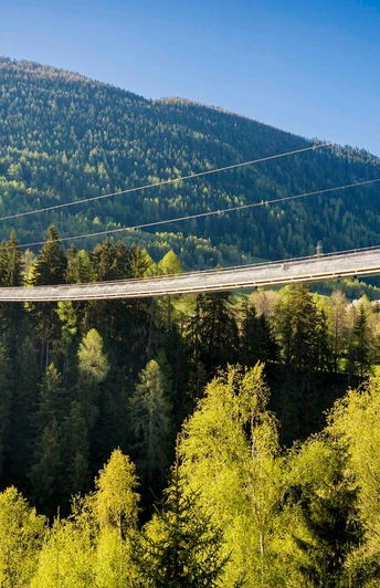
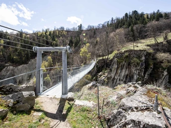
These bridges must be crossed. 5 bridges, all with 1 goal: adventure at heady heights. A thrilling hike that gets the adrenaline pumping.
Map


